 look news india
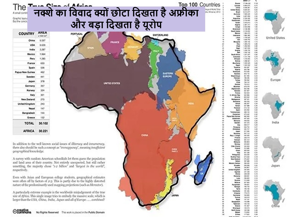
Newsindia Live, Digital Desk: We have all seen only one map of the world on books and walls since childhood, but is this map really right, this question is now gaining momentum and big organizations like African Union are demanding the removal of this traditional map. This world map used for centuries is known as Mercator Projection.
Actually Earth is round and accurately remove a round thing on a flat paper mathematically impossible. Mercury projection made a heavy compromise with the size of continents to keep the direction right. In this map, the country or continent which is far from the equator, the greatest example is that of its real size, the biggest example of this is almost the size of Greenland and Africa. In the continent of Africa, the continent is many times bigger than Greenland that America can get a large part of China and Europe together.
Similarly, Europe appears much larger than its real size, while continents like Africa and South America look shrunken and small. The African Union argues that it is not just a geographical mistake but it also shows a colonial mentality in which Europe has been tried to make Europe look more important in the center of the world. The map should be removed and brought to a map that presents all countries and continents correctly in their actual size