 look news india

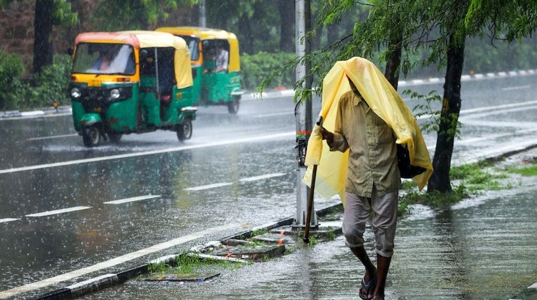
Weather Update Today 13 November 2026: With the passing of the second week of November, a major change is being seen in the weather across the country. On one hand, shallow to moderate fog and mist have knocked in the plains of North India in the morning, while on the other hand, rain and snowfall is continuing in the hilly states due to the activation of Western Disturbance. According to the latest bulletin of the Indian Meteorological Department (IMD), today on Friday, 13 November 2026, a low pressure area is going to form over the south-eastern Bay of Bengal, which may become more intense while moving towards the north-west in the next 24 hours. Due to the impact of these weather systems, the Meteorological Department has issued an alert of heavy rain in South India and island groups and snowfall with thunderstorms and lightning in the hilly states of the North.
According to the forecast of the Meteorological Department, due to the low pressure system forming in the Bay of Bengal, there is a strong possibility of heavy rainfall at different places in Andaman and Nicobar Islands today on November 13 and tomorrow on November 14. During this period, strong winds at a speed of 30 to 40 kilometers per hour may occur along with thunderstorms in the island groups. At the same time, if we talk about South Peninsular India, light to moderate rain with thunder and lightning will continue in Tamil Nadu, Puducherry and Karaikal today and tomorrow, while on 15 and 16 November, an alert has been issued for a new round of heavy rain in Tamil Nadu, Kerala and Mahe. In view of the rough sea conditions, the Meteorological Department has issued a strict warning to fishermen not to venture into the Andaman Sea and south-eastern Bay of Bengal between November 13 and 15.
The effect of active western disturbance still persists in the hilly areas of North India. The Meteorological Department has issued a yellow alert for thunder and lightning and strong winds with a speed of 40 to 50 km per hour (gusts up to 60 km/hour) in many parts of Jammu and Kashmir, Ladakh, Gilgit-Baltistan and Muzaffarabad today. A sharp drop in temperature is being recorded due to fresh snowfall in the high altitude hilly areas and rain in the lower areas. Apart from this, there is a possibility of sporadic rain and snowfall on higher peaks in the hilly districts of Himachal Pradesh and Uttarakhand (like Uttarkashi, Chamoli, Rudraprayag, Pithoragarh, Kinnaur and Lahaul-Spiti) today. This snowfall on the mountains is now going to have a direct impact on the cold of the plains.
There was fog and light to moderate fog at most places in the national capital Delhi-NCR this morning. According to the Meteorological Department, there is no rain alert in Delhi, Noida, Ghaziabad and Gurugram today and it may remain partly cloudy during the day. Due to low wind speed, the pollution and smog situation remains severe in Delhi, where today the maximum temperature is expected to be between 28°C to 30°C and the minimum temperature is expected to be between 16°C to 18°C. At the same time, in Uttar Pradesh (Lucknow, Prayagraj, Varanasi, Agra, Kanpur), Bihar and Punjab-Haryana, light haze and pink cold have started increasing in the morning and night. According to Lucknow Meteorological Centre, there is no severe weather warning in UP today and the sky will remain mainly clear.
| city name | maximum temperature | minimum temperature | Today’s Weather Forecast (IMD) |
| New Delhi | 29°C – 30°C | 16°C – 17°C | Light to moderate fog/mist in the morning, partly cloudy during the day |
| Lucknow | 31°C – 32°C | 17°C | Light fog in the morning, dry weather and clear sky during the day. |
| Patna | 28°C – 29°C | 18°C | Light fog in the morning, drop in temperature with cold winds |
| Jaipur | 30°C – 31°C | 17°C | Partly cloudy, dry weather |
| Mumbai | 33°C – 34°C | 23°C | The sky will be clear, slight humidity and heat during the day. |
| Chennai | 30°C – 31°C | 24°C | It will be cloudy, light to moderate rain with thunder and lightning |
| Srinagar | 13°C – 14°C | 3°C – 4°C | It will be cloudy, alert of rain/snow and strong winds |
According to meteorologists, as the cold winds coming from the north-western direction move towards the plains, a further drop of 2 to 3 degrees Celsius will be recorded in the night minimum temperatures in Uttar Pradesh, Delhi, Rajasthan, Madhya Pradesh and Bihar in the next two to three days. In view of the possibility of reduced visibility due to fog on highways and expressways in the morning, drivers have been advised to use fog lights and drive at controlled speed. At the same time, tourists traveling to hilly states and residents of coastal areas should keep an eye on the latest warnings from the Meteorological Department.