 look news india

Monsoon 2025 is now in its final stages, but on the go, it is preparing to show its rage once again. The Indian Meteorological Department (IMD) has issued a serious warning, which has raised the concern of many coastal states of South India. According to the warning, Bay of Bengal of Bengal A new and powerful above Low-Pressure Area There is a strong possibility of formation, which can take the form of a cyclonic circulation in the next 24 to 48 hours.
Due to this weather system in the coastal areas of Tamil Nadu, Puducherry and Andhra Pradesh Heavy to very heavy rain Is estimated. The administration has issued high alert and fishermen have been given strict advice not to go into the sea. Let us understand this seasonal movement in detail and know which areas will have the most impact.
How is this low pressure area and why is it so dangerous?
A low pressure area is formed when the sea surface temperature rises, causing the air on top of it to rise up. This empty space acts like a vacuum and pulls the cold and moisture -filled winds rapidly towards it.
This system, which is being built in the Bay of Bengal, is absorbing a large amount of moisture from the sea. When this system moves towards the coast, all this moisture will fierce the coastal areas as clouds, which can cause flood -like conditions in a few hours.
The most impact on Tamil Nadu and Puducherry
According to the Meteorological Department, the most direct and serious impact of this system Tamil Nadu and Puducherry But you will get to be seen.
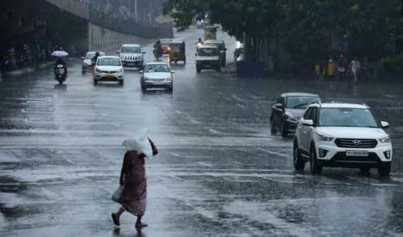
- Alert of heavy to very heavy rain: IMD has given many coastal districts of the state, especially Chennai, Chengalpattu, Kanchipuram, and Villupuram Orange Alert Has released. These areas can record 15 to 20 centimeters during the next 72 hours.
- Threat of urban floods: Due to heavy rains in metros like Chennai, there may be a serious problem of waterlogging and traffic jams in low -lying areas.
- Strong winds: Along with the rain, strong winds can also blow at a speed of 40 to 50 kilometers per hour, causing damage to weak structures and trees.
Nearby states are also affected
The impact of this system will not be limited to Tamil Nadu only.
- Southern Andhra Pradesh: A warning of heavy rains has also been issued in the southern coastal districts of Andhra Pradesh such as Nellore, Tirupati, and Chittoor.
- Kerala and Karnataka: Parts of Kerala and south internal Karnataka can also see moderate to heavy rains.
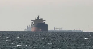
The biggest warning for fishermen
There is a possibility of very high and dangerous waves in the sea during this weather system. In view of this, IMD has issued a clear and strict warning for fishermen:
- Do not go to the sea: Fishermen from Tamil Nadu, Puducherry and Andhra Pradesh are given strict advice not to go to the sea fish for the next 3 to 4 days.
- Those who are in the sea should return: Fishermen who are already in deep sea were asked to immediately return to the coast.
Security advice for common citizens
The administration has also appealed to the common people to be vigilant and take some precautions:
- Do not leave the house if not necessary: Avoid traveling during heavy rain warnings.
- Stay away from old bridges and waterlogging paths: Do not risk crossing water filled underpasses and weak bridges.
- Caution from electronic devices: Stay away from electric poles and loose wires.
- Keep emergency kit ready: Keep an emergency kit ready that consists of flashlight, power bank, drinking water, and first aid.
The next few days are very important for these states of South India. Everyone is requested not to panic, but be fully cautious and pay attention to the official information released by the Meteorological Department.