 look news india

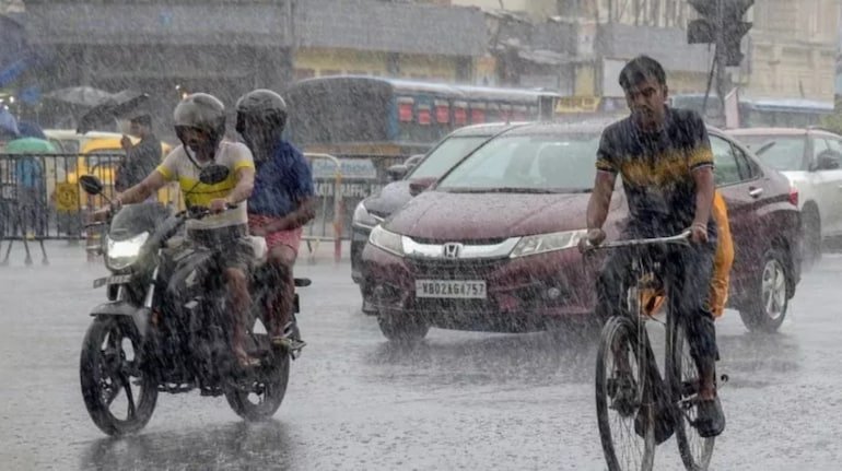
The trend of monsoon seems to be becoming aggressive once again across the country. According to the latest bulletin of India Meteorological Department (IMD), tomorrow i.e. on 8th September, monsoon clouds are going to rain heavily in more than twenty states of the country. Due to the influence of the cyclonic wind area over the North-West Bay of Bengal and the monsoon trough line passing through Central India, the weather is going to take a sudden turn in many areas of Eastern, Central and Northern India. Meteorologists have warned that there is a serious possibility of thunderstorms and lightning at a speed of 70 to 80 kilometers per hour in some states in the next 24 hours.
While in the plains of Eastern India the temperature may drop by four to five degrees due to continuous rains, there is a risk of landslides in the hilly areas. Due to the intense moist winds coming from the Bay of Bengal, the water level in the river valleys and coastal areas is likely to rise rapidly. The Meteorological Department has issued instructions to the local administration and disaster management units to remain alert so that any untoward situation can be dealt with immediately.
There will be a big change in the weather of Uttar Pradesh on 8th September. According to the Meteorological Department, the monsoon system is going to be active in full force in the eastern parts of the state i.e. Purvanchal. In districts like Gorakhpur, Deoria, Kushinagar, Maharajganj, Mau, Ballia, Azamgarh, Ghazipur, Varanasi, Jaunpur and Sonbhadra, torrential rains along with gusty winds at a speed of 60 to 70 kilometers per hour are expected on Tuesday.
There are chances of intermittent rains with dense movement of clouds in western Uttar Pradesh and central parts of districts like Kanpur, Etawah, Lucknow, Barabanki, Unnao, Ayodhya and Sultanpur. In the capital Lucknow, the maximum temperature tomorrow is expected to be around 31 degrees Celsius and the minimum temperature will be around 26 degrees Celsius. The Meteorological Department has instructed farmers in rural areas not to go to open fields and not to tie animals under trees, as incidents of lightning may increase.
After the rain in the last 24 hours in Bihar, monsoon activities may become more intense from tomorrow 8th September. Dense accumulation of clouds is occurring in the northern and eastern districts of the state. According to Meteorological Center Patna, orange and yellow alert of moderate to heavy rainfall has been issued in West Champaran, East Champaran, Sitamarhi, Madhubani, Darbhanga, Muzaffarpur, Shivhar, Samastipur, Supaul, Araria, Kishanganj, Purnia and Katihar.
There is a possibility of wind blowing at the speed of 30 to 50 kilometers per hour in these areas and heavy thunderstorms at many places. In the capital Patna, the maximum temperature can be recorded around 32 degrees Celsius and the minimum temperature can be recorded around 27 degrees Celsius. Due to continuous rainfall in the lowland areas of Nepal, the water level of Kosi, Bagmati, Gandak and Kamla Balan rivers is rising rapidly, due to which families living in low-lying areas have been asked to remain alert.
The low pressure area formed in the Bay of Bengal is going to have a direct and widespread impact on Odisha and West Bengal. Moderate to heavy rain may intensify in Odisha’s Keonjhar, Mayurbhanj, Balasore, Bhadrak, Sundergarh, Dhenkanal, Puri, Cuttack, Sambalpur, Balangir and capital Bhubaneswar on Tuesday. There has been a warning of strong storm and lightning at a speed of 60 kilometers per hour in the state. In view of the high waves and stormy winds in the sea, the Meteorological Department has strictly advised fishermen to stay away from the beach.
A new round of heavy rainfall is expected to begin in the Gangetic plains of West Bengal – Kolkata, Howrah, Hooghly, North and South 24 Parganas, Medinipur and Bankura from September 8. The day temperature in Kolkata is likely to be 32 degrees Celsius. Whereas in Ranchi, Jamshedpur, Dhanbad, Bokaro, West Singhbhum and East Singhbhum districts of Jharkhand, there is a warning of heavy showers with dense clouds and winds blowing at a speed of 40 to 50 km per hour. The maximum temperature in Ranchi can be 29 degrees and minimum 23 degrees Celsius.
The effect of monsoon circulation will remain in Central India. Torrential rains are expected in the central and eastern divisions of Madhya Pradesh – Jabalpur, Sagar, Rewa, Shahdol, Damoh, Satna, Sidhi, Chhindwara and Seoni. Apart from this, there may be light to moderate rain with thunder in some parts of Gwalior-Chambal region and Indore-Ujjain division. The maximum temperature in Bhopal is expected to be around 30 degrees Celsius and the minimum temperature is expected to be around 23 degrees Celsius.
There is a possibility of significant increase in rainfall activities in the neighboring state of Chhattisgarh from September 8. There is an alert of heavy rain with thunderstorm in Raipur, Bilaspur, Durg, Korba, Mahasamund, Janjgir-Champa, Dhamtari, Surajpur and Surguja. During this period the wind speed can reach up to 65 kilometers per hour. The administration has started continuous monitoring of the water level of Mahanadi and Shivnath river basins.
Talking about the northern plains, there may be a slight reduction in the intensity of monsoon rains in Delhi-NCR and Haryana on September 8. The sky will be partly cloudy in the capital Delhi, but there is less chance of widespread rain. The maximum temperature in Delhi can be recorded between 34 to 35 degrees Celsius and the minimum temperature can be recorded between 25 to 26 degrees Celsius. Due to lack of rain, mild humid heat during the day can bother people.
Eastern districts of Rajasthan—Alwar, Bharatpur, Dausa, Karauli, Kota and Baran may see light to moderate rainfall with local thundershowers, while Jaisalmer, Jodhpur and Barmer of western Rajasthan will see mainly dry weather. The weather will also be clear or partly cloudy in most parts of Punjab and Haryana, where the day temperature may go up to 36 to 37 degrees Celsius.
Rain and thundershowers will continue in the hilly districts of Uttarakhand – Dehradun, Nainital, Chamoli, Rudraprayag, Tehri, Pithoragarh, Bageshwar and Champawat on September 8. Due to heavy rains, there is a danger of landslides and boulder falls on sensitive hill slopes. Pilgrims traveling on Chardham Yatra routes have been advised to proceed only after taking information about the local weather. The maximum temperature in Dehradun tomorrow is expected to be 28 degrees and minimum 22 degrees Celsius.
In Himachal Pradesh, scattered showers are likely around Shimla, Kullu and Kangra, although the weather will remain relatively normal in most parts of the state. Parts of Jammu and Kashmir will remain partly cloudy and light drizzle may be recorded.
In view of the warnings of heavy rain and thunderstorm issued by the Meteorological Department, common citizens need to take some basic precautions:
Do not take shelter near any tree, tin shed, electric pole or transformer during storm and lightning. Keep switches of sensitive electronic equipment inside the house switched off.
While traveling by road, do not attempt to drive your vehicle through waterlogged roads, underpasses and weak culverts. At the time of lightning, farmers should move from their fields to safe permanent houses. Citizens of coastal states should keep an eye on the weather alerts of the district administration and avoid rumours.