 look news india

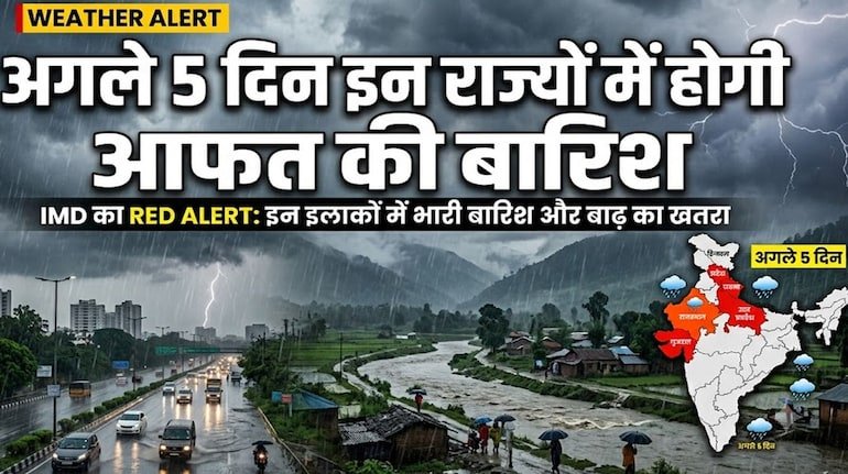
The active monsoon across the country is once again going to take a severe form. The Indian Meteorological Department (IMD), while issuing the latest weather bulletin, has issued a strict warning to remain cautious in many parts of the country for the next 5 days. A very strong weather system has been activated by the combination of a deep low pressure area over the Bay of Bengal, an active monsoon trough and a cyclonic circulation over northwest India.
Due to its impact, heavy to extremely heavy rains along with strong thunderstorms and lightning at a speed of 60 to 80 kilometers per hour have been expected in many districts of Madhya Pradesh, Uttar Pradesh, Bihar, Rajasthan, Uttarakhand, Himachal Pradesh, Chhattisgarh, Odisha and Gujarat. The Meteorological Department has issued orange and yellow alerts in sensitive areas and appealed to the citizens to be cautious.
Due to the extremely strong monsoon system in Madhya Pradesh, continuous rains are likely to continue in most divisions of the state. According to the Meteorological Department, intermittent heavy to very heavy rains may occur in the districts of Bhopal, Raisen, Vidisha, Sehore, Narmadapuram, Jabalpur, Sagar, Chhindwara and Gwalior-Chambal divisions for the next few days.
Due to continuous monsoon rains, the water level of major rivers like Narmada, Betwa, Chambal, Tapti and Kshipra is rising rapidly. There is a possibility of opening the gates of many major dams and releasing water, creating a flood-like situation and danger of waterlogging in low-lying areas. The local administration has issued a high alert in the villages and low-lying areas situated on the river banks.
Widespread seasonal changes are being seen in the plains of Uttar Pradesh and Bihar due to the shift of the monsoon trough. In the districts of Purvanchal and Terai belt of Uttar Pradesh like Gorakhpur, Varanasi, Prayagraj, Ghazipur, Ballia, Bahraich, Lakhimpur Kheri and surrounding areas of Lucknow, torrential rains along with thunderstorms are expected for the next 5 days.
There is a big danger of lightning strike along with heavy rain in Patna, Gaya, Muzaffarpur, Bhagalpur, Purnia and East Champaran districts of Bihar. Meteorologists have especially advised farmers working in rural areas and open fields to take shelter in pucca houses during severe thunderstorms.
Due to heavy rains in Uttarakhand and Himachal Pradesh, the crisis of landslides, boulder falling and blocking of roads may deepen further. Special monitoring is being done on the sensitive landslide zones on the Chardham Yatra routes – Badrinath, Kedarnath, Gangotri and Yamunotri Highway. Tourists and local residents have been warned to avoid unnecessary mountain trips.
In Western India, heavy rains with strong winds and thunderstorm are likely to continue for the next 3 to 5 days over East Rajasthan (Jaipur, Kota, Udaipur, Bharatpur) and many parts of Gujarat. Fishermen in the coastal areas of Saurashtra and Kutch have been advised not to venture into the sea.
There will be dense cloud movement in the capital Delhi and National Capital Region (Noida, Ghaziabad, Gurugram and Faridabad) during the next 5 days. At many places, spells of light to moderate and heavy rain may be seen in some areas, which will bring down the temperature and provide relief from the humid heat. However, heavy rains may cause traffic jams and waterlogging on major roads and underpasses.
In view of inclement weather and possible natural disasters, the Meteorological Department has issued guidelines for the public and administration:
-
Do not stand under trees, dilapidated walls and electric poles during storms and lightning.
-
Keep electronic devices unplugged and avoid driving on waterlogged roads.
-
Farmers should keep their harvested or prepared crops in safe places and postpone spraying pesticides until the weather clears.
-
Stay connected to the helpline numbers of local disaster management authority (NDRF/SDRF) and district administration for any emergency.