 look news india

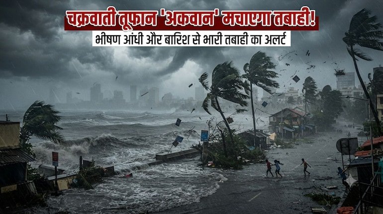
The severe cyclonic storm ‘Akvan’ formed in the Bay of Bengal is rapidly moving towards the Indian east coast and its biggest impact will be seen tomorrow i.e. Friday, 20 November 2026. According to the latest national bulletin of the India Meteorological Department (IMD), the cyclonic system, moving in a north-westerly direction, will make landfall around noon tomorrow between Narsapur in northern Andhra Pradesh and Puri in southern Odisha—especially near Gopalpur east coast. At the time of landfall, permanent winds will blow at a speed of 90 to 100 kilometers per hour in coastal areas, while the speed of gusting winds can reach up to 110 kilometers per hour. In view of the threat of the storm, about one lakh people have so far been evacuated to safe cyclone shelters in Odisha and Andhra Pradesh, 31 NDRF teams have been deployed and more than 19 passenger trains and many flights, including the Howrah-Puri Vande Bharat Express, have been cancelled.
The worst form of cyclone ‘Akwan’ will be visible in the coastal districts of Odisha and Andhra Pradesh tomorrow on 20th November. IMD has issued a Red Alert in view of the possibility of extremely heavy rainfall (more than 20 cm) and strong thunderstorm in Kendrapara, Jagatsinghpur, Puri, Ganjam, Gajapati and Kandhamal districts of Odisha. Red alert of extremely heavy rain has been declared in Srikakulam, Vizianagaram and Parvatipuram Manyam districts of Andhra Pradesh, while orange alert has been issued for Aluri Sitarama Raju (ASR) and Anakapalle districts. The Meteorological Department has warned that waves up to 9 to 14 meters high will rise in the sea and sea water (Storm Surge) can enter 0.5 to 1 meter above the normal tide in the low-lying coastal areas of Gopalpur and Puri. As a precautionary measure, schools and colleges are closed in 6 districts of Odisha, Bhitarkanika National Park and Similipal Tiger Reserve have been closed and a complete ban has been imposed on fishermen from going into the sea till November 21.
After hitting the coast, Cyclone ‘Akwan’ will weaken and move northwards as a deep depression, which will cause torrential rains in many states of eastern and central India tomorrow. In West Bengal, the weather department has issued an orange alert of heavy to very heavy rain in East Medinipur, West Medinipur, Jhargram, Bankura and South 24 Parganas districts, while there is a yellow alert of heavy rain and strong winds of 50 to 60 km per hour in Kolkata, Howrah, Hooghly, North 24 Parganas and Purulia. A yellow alert has been issued in 11 districts of Jharkhand – Ranchi, Lohardaga, Gumla, Simdega, Ramgarh, Khunti, Bokaro, Dhanbad, Seraikela-Kharsawan, East and West Singhbhum – from 8:30 am tomorrow for heavy rain and strong storm with a speed of 50 km per hour for the next 24 hours. Apart from this, there are chances of moderate to heavy rains with thunderstorms in northern and central Chhattisgarh, Telangana and coastal areas of northern Tamil Nadu and Puducherry tomorrow.
Talking about the plains states, the moisture effect of the cyclonic system will start being visible in Bihar from tomorrow, November 20, due to which there is a possibility of cloudy sky and drizzle with strong winds at the speed of 40 to 50 km per hour in the districts of Southern and Eastern Bihar, while the maximum temperature in Patna will be around 28°C and minimum 17°C. The weather will be mainly dry in Uttar Pradesh tomorrow on 20th November, but there will be dense fog and cold in the morning in the capital Lucknow, Kanpur, Agra, Meerut, Noida, Ghaziabad, Varanasi, Prayagraj and Gorakhpur. The maximum temperature in Lucknow tomorrow is expected to be 28°C and the minimum temperature will be 14°C, while the districts of Purvanchal may receive light rain with thunder on 21st November. Whereas in Delhi-NCR tomorrow morning there will be moderate to dense fog and winds of 20 to 30 km per hour, the maximum temperature will be recorded between 26°C and the minimum temperature will be between 12°C to 13°C.
Due to the effect of western disturbance, the cold has increased further in the hilly states of Himachal Pradesh, Uttarakhand and Jammu and Kashmir. The minimum temperature in Manali is expected to drop to minus 5 degrees Celsius tomorrow, while the minimum temperature in Srinagar will be 2°C and in Dehradun it will be 12°C. The Meteorological Department has advised rail and air passengers traveling to Eastern India and coastal states to check the latest status of their train or flight before leaving home, while farmers of UP-Bihar and Jharkhand have been asked to immediately keep the harvested paddy crop in a safe place.