 look news india

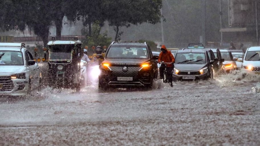
The south-west monsoon has once again taken a vigorous and aggressive stance across the country. Due to the low-pressure area formed in the Bay of Bengal and the northward shift of the active monsoon trough, huge movements are being seen in the weather systems. While issuing the latest weather bulletin, the Indian Meteorological Department (IMD) has issued a widespread alert of strong thunderstorms, lightning and torrential rains in more than 20 states of the country. According to meteorologists, during this period the wind speed in many plains and coastal areas can reach 70 to 80 kilometers per hour. There will be dense clouds in the sky from the capital Delhi, Uttar Pradesh, Bihar to West Bengal, Rajasthan and Madhya Pradesh and a sharp change in the weather will be seen in the next 48 to 72 hours.
Cloud camp in North and East India: Showers from Delhi-NCR to Bengal
According to the Meteorological Department, monsoon winds are fully active in the Ganga coastal plains of north-west and eastern India.
-
Rain and storm in Delhi-NCR: Moderate to heavy rain with thunderstorms is expected in the capital Delhi and surrounding cities (Noida, Gurugram, Ghaziabad, Faridabad). During this period, due to strong winds blowing at a speed of 40 to 60 km/hour, the temperature will drop by 3 to 4 degrees Celsius, which will provide relief to people from the humid heat.
-
Danger of lightning in Uttar Pradesh and Bihar: Yellow and orange alert of heavy rain has been issued in more than 40 districts of eastern and western Uttar Pradesh. A serious warning has been given of lightning strike along with thunder in Bihar’s Patna, Gaya, Bhagalpur, Purnia and Muzaffarpur, due to which farmers and common people have been advised not to go to open fields.
-
Heavy rainfall in West Bengal and Odisha: Due to the impact of the system over the Bay of Bengal, there is a possibility of heavy to very heavy rainfall with strong storm winds over the entire coastal districts of West Bengal and Odisha including Kolkata, Howrah, Jalpaiguri, Darjeeling.
Landslide alert on mountains: Vigilance in Himachal and Uttarakhand
This new wave of monsoon can emerge as a disaster in the hilly states. The Meteorological Department has issued a special advisory for the sensitive hill districts of Himachal Pradesh and Uttarakhand:
-
Red and orange alert in Uttarakhand: Due to extremely heavy rains in Dehradun, Nainital, Rudraprayag, Chamoli, Pauri Garhwal and Bageshwar, the water level of rivers is rising rapidly. In view of the danger of landslides and rockslides on many major routes, Chardham pilgrims have been asked to stay at safe places and travel only after checking the weather forecast.
-
Himachal Pradesh and Jammu and Kashmir: Shimla, Kullu-Manali, Kangra and Mandi may experience heavy rain and stormy winds at a speed of 60 to 70 km/hour. Local administration and SDRF teams have been put on high alert in areas prone to flash floods and debris falls.
Central and Western India: Impact of the system in Rajasthan, MP and Gujarat
Cyclonic Circulation of Monsoon is showing its full strength in Central and Western states also:
-
System active in Madhya Pradesh: Continuous torrential rains are expected to continue in most parts of the state including Bhopal, Gwalior, Sagar, Rewa, Guna and Jabalpur. Due to the possibility of gates of many dams being opened, an alert has been issued in the low-lying areas.
-
Heavy storm and rain in Rajasthan: There are chances of strong thunderstorm and heavy rain with speed of 70 to 80 km per hour in eastern and western Rajasthan (Jaipur, Kota, Udaipur, Bikaner and Jodhpur). Life can be affected due to dust storm and rain in desert areas.
-
Gujarat and Maharashtra: Intermittent heavy rains will continue over Saurashtra, Kutch, South Gujarat and Konkan-Mumbai belt. Due to high waves in the sea, fishermen have been given strict instructions not to venture into the deep sea.
Rain with strong winds in southern and northeastern states also
The water level of Brahmaputra and its tributaries is on the rise due to continuous rains in the northeastern states of Assam, Meghalaya, Arunachal Pradesh, Tripura and Nagaland. The states of South India – Karnataka, Coastal Andhra Pradesh, Telangana, Kerala and Tamil Nadu are also expected to receive thunderstorms for the next three days due to the influence of Western Disturbance and trough line.
Do’s and don’ts during bad weather: IMD’s safety advisory
-
Stay away from trees and electric poles: During storm winds of up to 80 km/hour, weak trees, hoardings and electric wires can break and fall. Do not take shelter under any old tree or tin shed during a thunderstorm.
-
Do not stay in the open during lightning: If you are traveling or in an open field, immediately go to a permanent house. Maintain distance from water sources and metal objects.
-
Avoid waterlogged roads: During heavy rains, there may be a problem of waterlogging in underpasses and low-lying roads in cities. While driving, slow down your speed and maintain a safe distance.
-
Advice for farmers: Keeping in view the possibility of strong wind and waterlogging, keep the harvested crops in safe sheds and make arrangements for drainage of excess water from the fields.