 look news india

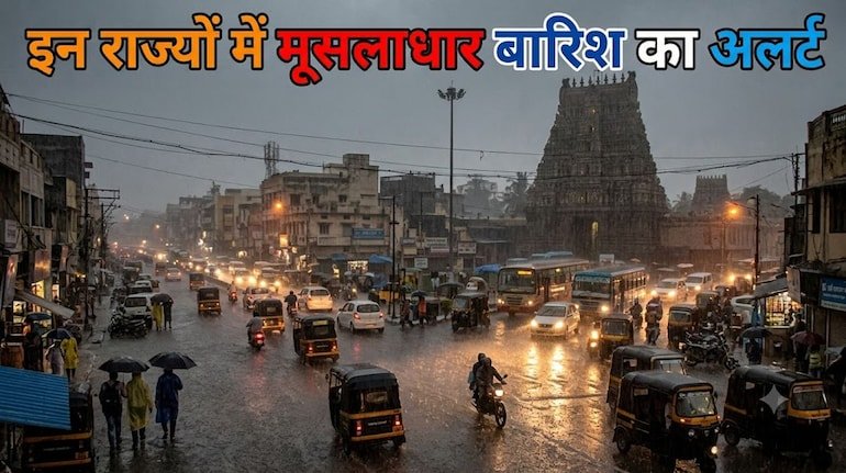
Before the departure of monsoon, big and dangerous changes are being seen in the weather of North and Central India. According to the latest seven-day national bulletin issued by the India Meteorological Department (IMD), from September 7 to September 13, 2026, monsoon clouds are going to rain very aggressively in many states of the country. According to meteorologists, the low-pressure area formed in south-west Uttar Pradesh and its adjoining areas has now concentrated over the central parts of the state. This weather system along with intense moist easterly winds from the Bay of Bengal and activation of the monsoon trough is causing heavy cloud cover across North and East India.
The Meteorological Department has clarified that this week is going to be much wetter and more sensitive than normal. Especially between September 7 and 9, extremely heavy rainfall and lightning are expected in many districts of Uttar Pradesh, Bihar, Uttarakhand and Sub-Himalayan West Bengal. At the same time, a new low pressure area is also rapidly taking shape in the next 48 hours towards West Bengal via North Odisha and Jharkhand, due to which the risk of creating conditions like waterlogging, overflowing of rivers and floods in low-lying areas in the eastern states has increased.
The most widespread impact of the low-pressure system centered on Uttar Pradesh is being seen in the districts of this state. According to the latest data of Meteorological Center Lucknow, on September 7 and 8, there will be widespread rainfall with dense presence of clouds in the entire state. While in the districts of Western Uttar Pradesh – Saharanpur, Muzaffarnagar, Meerut, Moradabad, Bareilly, Pilibhit and Badaun, torrential rains with thunder and lightning have been recorded on September 7, the orange alert of heavy to very heavy rains remains in force in Eastern Uttar Pradesh i.e. Purvanchal on September 8.
In districts like Gorakhpur, Deoria, Kushinagar, Maharajganj, Azamgarh, Ballia, Varanasi, Jaunpur, Ghazipur and Mirzapur, there will be a danger of stormy winds blowing at a speed of 40 to 50 kilometers per hour and strong lightning strikes on September 8 and 9. Intermittent showers and drop in temperature are also expected in the capital Lucknow, Kanpur, Unnao, Ayodhya and Sultanpur by the middle of the week. Meteorologists have advised farmers to avoid taking shelter in open spaces or under large trees while working in the fields, as the risk of damage to life and property due to lightning increases.
The entire coming week is considered to be very sensitive in terms of weather for the hilly state of Uttarakhand. According to the Meteorological Department, after torrential rains on September 7, another intense phase of heavy to very heavy rainfall is going to be active in Uttarakhand between September 10 and 13. A warning of heavy rain with thunder and lightning has been issued in Dehradun, Nainital, Pithoragarh, Chamoli, Rudraprayag, Tehri, Uttarkashi and Bageshwar districts.
Due to continuous rains, incidents of mudslides, rockslides on hill slopes and boulder falls on major roads may increase. Chardham pilgrims traveling on Rishikesh-Badrinath, Gangotri and Yamunotri national highways have been asked to strictly follow the local advisory issued by the State Disaster Management Authority (USDMA). Instructions have also been issued to local residents living near rivers, streams and sensitive valleys to stay in safe places in view of possible flash floods.
Bihar remains the main center of monsoon rains in the plains of eastern India. According to IMD’s seven-day forecast, Bihar will receive widespread heavy rainfall during September 7 to 9, while extremely heavy rainfall is expected at isolated places in the state between September 8 to 10. There is an alert of severe thunderstorm and lightning in border districts like West Champaran, East Champaran, Sitamarhi, Madhubani, Kishanganj, Araria, Purnia, Katihar and Supaul.
Due to simultaneous rains in the Terai areas of Nepal and North Bihar, the water level of Kosi, Bagmati, Kamla Balan and Gandak rivers may reach near the danger mark. On the other hand, moderate to heavy rainfall, intense thunder and gusty winds at a speed of 30 to 40 km per hour are expected in Jharkhand from September 8 to 11. Waterlogging problem may arise in Ranchi, Jamshedpur, Dhanbad, Bokaro and Chaibasa, due to which life is likely to be affected.
The activity of monsoon circulation is going to continue throughout the week in the states of Central India. After rain in Western Madhya Pradesh on September 7, heavy rainfall has been predicted in Eastern Madhya Pradesh – Jabalpur, Rewa, Sagar, Shahdol, Damoh, Satna and Chhindwara on September 7, 8, 11 and 12. Along with this, a warning has been given that winds will blow at a speed of 30 to 40 km per hour.
There will be cloud cover in the neighboring state of Chhattisgarh from September 8 to 12, where torrential rain and lightning along with thunderstorms are expected at many places. The water level of local rivers and dams is being continuously monitored in Raipur, Bilaspur, Korba, Durg and Bastar divisions so that sudden waterlogging can be avoided.
The monsoon system will remain active in full force in the states of Northeast India for seven days. Continuous heavy rain is forecast in Assam and Meghalaya from 7 to 13 September. Arunachal Pradesh may receive torrential rainfall between September 8-9 and September 11-13, while spells of heavy rain will continue throughout the week in Nagaland, Manipur, Mizoram and Tripura.
Talking about the west coast, widespread rainfall will continue in Konkan and Goa till September 13. In South India, heavy rain is expected in Kerala and Mahe between September 10 and 12, while parts of Tamil Nadu and Telangana may see scattered rain with strong winds. In contrast, there is a possibility of cloudy sky and light drizzle for the rest of the week after the rain on September 7 in Delhi-NCR, Haryana and Punjab, where no major alert has been announced.
In view of this weather system active over large parts of the country between September 7 and 13, disaster management agencies have issued some important life-saving precautions for citizens:
Whenever there is lightning or strong storm in the sky, avoid standing in any open field, field, electric pole, transformer or under tall trees. Keep switches of electronic appliances like TV, computer and refrigerator inside the house switched off.
While traveling by road, do not try to get the vehicle out of heavily waterlogged underpasses and submerged culverts. Before traveling to hilly areas, get the latest status of the routes from the concerned state police and disaster control room and avoid non-essential trips until the weather becomes normal.