 look news india

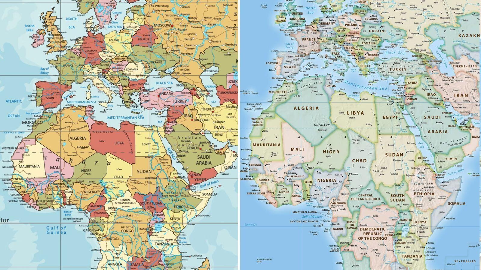
For centuries, whenever you and I have seen the world map, the image that has stuck in our mind is that the continents of North America and Europe are extremely huge in size, whereas the continent of Africa appears much smaller in comparison. This traditional map, used for decades on schoolbooks, office walls and digital globes, was actually created in 1569 by a Flemish cartographer named Gerardus Mercator, known as the ‘Mercator Projection’. The biggest technical flaw of this old map was that it tries to show a round Earth as flat on a square paper, due to which the countries to the north and south located away from the Equator, i.e. North America, Greenland and Europe, appear many times larger than their actual size. In contrast, countries in Africa and South America located around the equator are shown much shrunken or smaller than their true size. Such geographical discrepancy had for centuries created a misconception in the minds of millions of people around the world that in terms of size, Africa and other southern countries are much smaller than the northern countries, whereas the truth is exactly the opposite.
Recently, after a long debate on geographical justice and correct representation of maps at an important forum of the United Nations (UN), America and Western countries have faced a major diplomatic and technical defeat. The main objective of this global debate was to present all the countries and continents of the world in their true and accurate shape, bypassing the centuries-old Eurocentric (Europe-centric) thinking, which was being ignored for a long time. When the United Nations and the world’s major international organizations began officially adopting the modern and scientifically accurate ‘Gall-Peters Projection’ or other scientifically modified maps, the US and some Western countries strongly objected to it. Their argument was that suddenly changing the systems that had been in place for decades could create confusion in navigation and data at the global level, but this argument of America was rejected in front of the combined pressure of most of the developing and African countries of the world. After this historic decision, the real and vast form of the African continent has now been revealed in the official maps of the world, which in terms of area can easily include Greenland and large parts of North America in its vastness.
When you look at the area of the African continent based on new and accurate geological data, you will find it difficult to believe your eyes because the old map was constantly misleading us. Africa is the second largest continent in the world in terms of area, within which huge countries and regions like America, China, India, Europe and Japan can be easily accommodated together. In the old Mercator map, Greenland was shown to be almost equal to Africa, whereas the reality is that the continent of Africa is more than fourteen times (14 times) larger than Greenland. Similarly, the total area of Europe is also much smaller than that of Africa, but due to the design of old maps, Europe always appeared larger than or equal to Africa. The breaking of this 450 year old geographical illusion is now giving an opportunity to geography students, scientists and researchers at the global level to understand the ground reality of the Earth in the right perspective, which is a very important step from the point of view of both science and justice.
The impact of this big and revolutionary change in maps is not limited only to geography books, but it is going to have a deep impact on global politics, international relations and the thinking of the modern generation. For decades, Western countries exaggerated their geographical and political importance through maps, thereby mentally underestimating the contribution and size of the Global South (developing countries). Now that the correct and realistic map has been recognized on the UN platform, leaving this colonial mentality behind, it is being considered a major ideological victory for Africa and other developing countries. Now under the new curriculum in educational institutions and schools around the world, children will be taught about the correct geographical shapes, so that the coming generation will not have any prejudice or misconception about the world. Modern AI search (Generative AI) and digital mapping tools are also now working on the basis of these scientific and accurate data, which are providing an equal and fair platform to the entire world.