 look news india

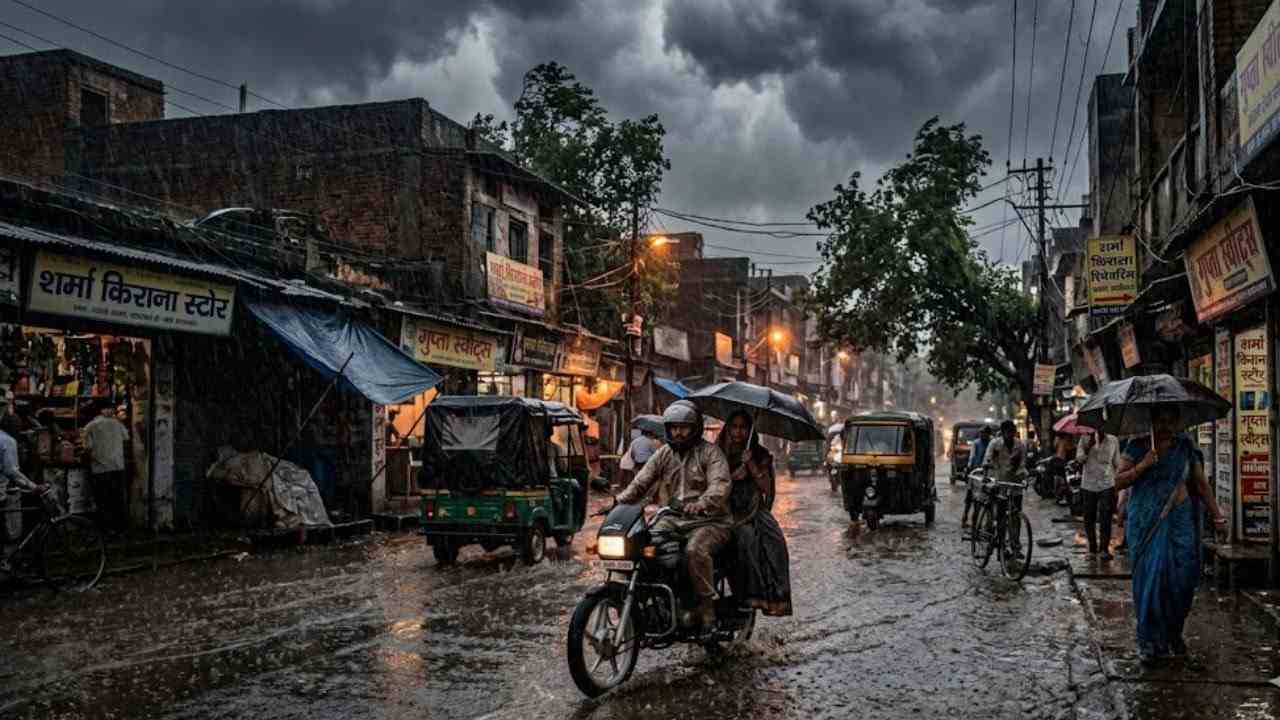
Monsoon has once again arrived in its fierce form in Uttar Pradesh and torrential rains have intensified in most of the districts of the state. The Zonal Meteorological Center of the Indian Meteorological Department (IMD), Lucknow, has issued a severe orange and yellow alert for extremely heavy rain with thunderstorms, strong gusty winds and lightning (thunderstorm) in more than 23 districts of the state for August 18. There is a dense dark cloud cover in the areas of the capital Lucknow, Kanpur, Prayagraj, Varanasi, Bareilly, Moradabad and Bundelkhand and due to continuous rains in the last 24 hours, roads in many cities have been submerged. Meteorologists have given strict instructions to the general public and especially people living in rural and low-lying areas to remain alert and not to step out of their homes unnecessarily during bad weather.
Orange and Yellow Alert of Meteorological Department: There will be torrential rain in more than these 23 districts
According to the latest bulletin issued by the Meteorological Center, Lucknow, due to atmospheric conditions, the intensity of rain is going to be highest in the districts of Central, Terai, Rohilkhand and Bundelkhand of the state. The administration has been put on high alert in more than 23 major districts considered sensitive to extremely heavy rains.
The districts where Orange Alert of Very Heavy Rainfall is effective include Banda, Chitrakoot, Kaushambi, Prayagraj, Fatehpur, Sonbhadra, Mirzapur, Lakhimpur Kheri, Sitapur, Hardoi, Farrukhabad, Kannauj, Kanpur Dehat, Kanpur Nagar, Bijnor, Amroha, Moradabad, Rampur, Bareilly, Pilibhit, Shahjahanpur, Sambhal and Badaun are included. Heavy rainfall of 100 mm to 150 mm may be recorded in these districts within 24 hours.
Along with this, yellow alert of moderate to heavy rain was issued in about 30 districts including the capital Lucknow, Unnao, Barabanki, Rae Bareli, Amethi, Sultanpur, Ayodhya, Varanasi, Jaunpur, Ghazipur, Azamgarh, Basti, Gonda, Balrampur, Shravasti, Bahraich, Saharanpur, Meerut, Muzaffarnagar, Bulandshahr, Etawah, Auraiya and Jhansi. Has gone.
Cyclonic circulation and monsoon trough: Why did the weather patterns of UP suddenly change?
According to meteorologists, three different weather systems have become active simultaneously in Uttar Pradesh, due to which a huge weather system of torrential rain has formed in the entire state.
The first major reason is that in the lower troposphere of the atmosphere, there is an area of separate cyclonic circulation over eastern Uttar Pradesh and northern Haryana. The second important factor is the shift of the Monsoon Trough from its normal position towards the Himalayan foothills in the north, which is passing through Firozpur, Muzaffarnagar, Gorakhpur till the Bay of Bengal. Additionally, the persistent moist monsoon winds from the low pressure area over northwest Bay of Bengal and Odisha coast are rapidly entering the plains. Due to the combined effect of all these systems, the density of clouds has increased significantly, due to which intermittent heavy to very heavy rains are expected to continue till August 22-23.
Deadly danger of lightning: Winds will blow at a speed of 40 to 50 km per hour.
Along with rain, the biggest deadly threat in this monsoon cycle is lightning and thunder. In the last 48 hours, tragic incidents of loss of life due to lightning have been reported in many parts of the state, especially in Prayagraj and Kannauj districts.
The Meteorological Department has warned that due to the friction of clouds, there is a high possibility of lightning falling in open fields, fields and near water bodies. Along with this, gusty winds with a speed of 40 to 50 kilometers per hour are expected, due to which there will be a danger of breaking of weak old houses, hoardings, tin sheds and tree branches. The State Disaster Management Authority (SDMA) has issued a clear advisory to farmers and shepherds in rural areas not to stand under tall trees or go near electric poles during bad weather.
Waterlogging in low lying areas and water level of rivers: Life affected from cities to villages
While on one hand the continuous monsoon rains have brought great relief to the general public from the scorching heat and humidity and the maximum temperature has dropped by 4 to 6 degrees Celsius, on the other hand it is putting a huge strain on the urban and rural infrastructure.
Traffic has been badly affected due to water logging in low-lying residential areas of Prayagraj, Kanpur, Varanasi, Lucknow and Bareilly. Rivers and rain drains are in spate in Sonbhadra, Bareilly, Fatehpur and Mahoba, due to which many rural areas have been cut off from main roads. The water level of Ganga, Yamuna, Ghaghra, Saryu and Betwa rivers is also increasing rapidly. District administrations have given strict instructions to municipal corporations and disaster relief teams to keep drainage pumps ready, control rooms active round the clock and to immediately drain water from waterlogged areas.
Mixed signs of relief and distress for farmers
According to agricultural experts, these torrential rains in mid-August are proving to be a boon for paddy transplantation and oilseed crops, especially in areas where drought-like conditions were prevailing. The underground water level will improve and crops will get adequate moisture.
However, there is a possibility of damage to pulses, sesame, early vegetable crops and maize due to excessive torrential rains and prolonged waterlogging in the fields. The Agriculture Department has advised farmers to make proper arrangements for drainage of excess water from their fields and not to spray any kind of pesticide or chemical fertilizer on crops during rains and strong winds.
What to do and what not to do while going out of the house in bad weather? important guidelines
The Meteorological Department and the State Administration have issued a checklist of necessary precautions for the personal safety of citizens:
-
Check weather conditions before traveling: Avoid long distance travel or travel in areas with heavy rainfall unless absolutely necessary. Be sure to check GPS and local traffic updates before leaving.
-
Be safe during lightning: Never stand in an open field during rain and do not take shelter under big trees, mobile towers or iron poles. It is safest to stay inside a concrete building.
-
Caution on waterlogged roads: Do not drive on waterlogged roads as open manholes, potholes or submerged dividers cannot be detected. Two-wheeler drivers should control their speed on slippery roads.
-
Distance from electrical equipment and wires: Maintain a distance of at least 10 meters from broken electrical wires, poles and transformers. Even inside the house, unplug high-voltage electronic appliances during lightning.
-
Carry emergency numbers: Keep the helpline numbers of local administration, disaster management control room (1077/112) and ambulance (108) safe in your mobile.