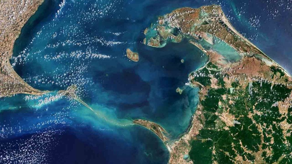
A satellite image of Ram Setu has been shared. The European Space Agency has taken this image from the Copernicus Sentinel-2 satellite, which it has shared on its X account. The photo shows Ram Setu, a limestone structure extending from Rameswaram in Tamil Nadu to Mannar Island in Sri Lanka, also known as Adam's Bridge. According to mythological texts, Ram Setu was built by Lord Rama with the help of his army. At the same time, now the European Space Agency has said that Ram Setu was passable till the 15th century, but then it was cut in many places due to sea storms.
The length was 48 km
Ram Setu is a 48-km-long bridge between Rameswaram in India and Mannar Island on the northwestern coast of Sri Lanka. According to mythological beliefs, Lord Rama and his army crossed the sea to reach Lanka to fight Ravana. There were also plans to demolish parts of the bridge due to the Sethusamudram Shipping Canal Project. The report said that some of the sand dunes here are dry, while the sea here is very shallow, only 1-10 meters deep, which is revealed by the light colour of the water. Spread over about 130 square kilometers, Mannar Island is connected to the mainland of Sri Lanka by road bridges as well as railway bridges. Both of these are visible at the southern end of the island.
Now fish and turtles live here
The European Space Agency also said that many types of birds live on these sand dunes, such as the brown noddy. Apart from this, many types of fish and seagrass are also found in shallow water. Marine life around Adam's Bridge includes dolphins, dugongs and turtles. This year, Indian Prime Minister Narendra Modi visited Arichal Munai, the starting point of Ram Setu. Meanwhile, news also came that the bridge will have to be built again to connect India and Sri Lanka.
 look news india

