 look news india

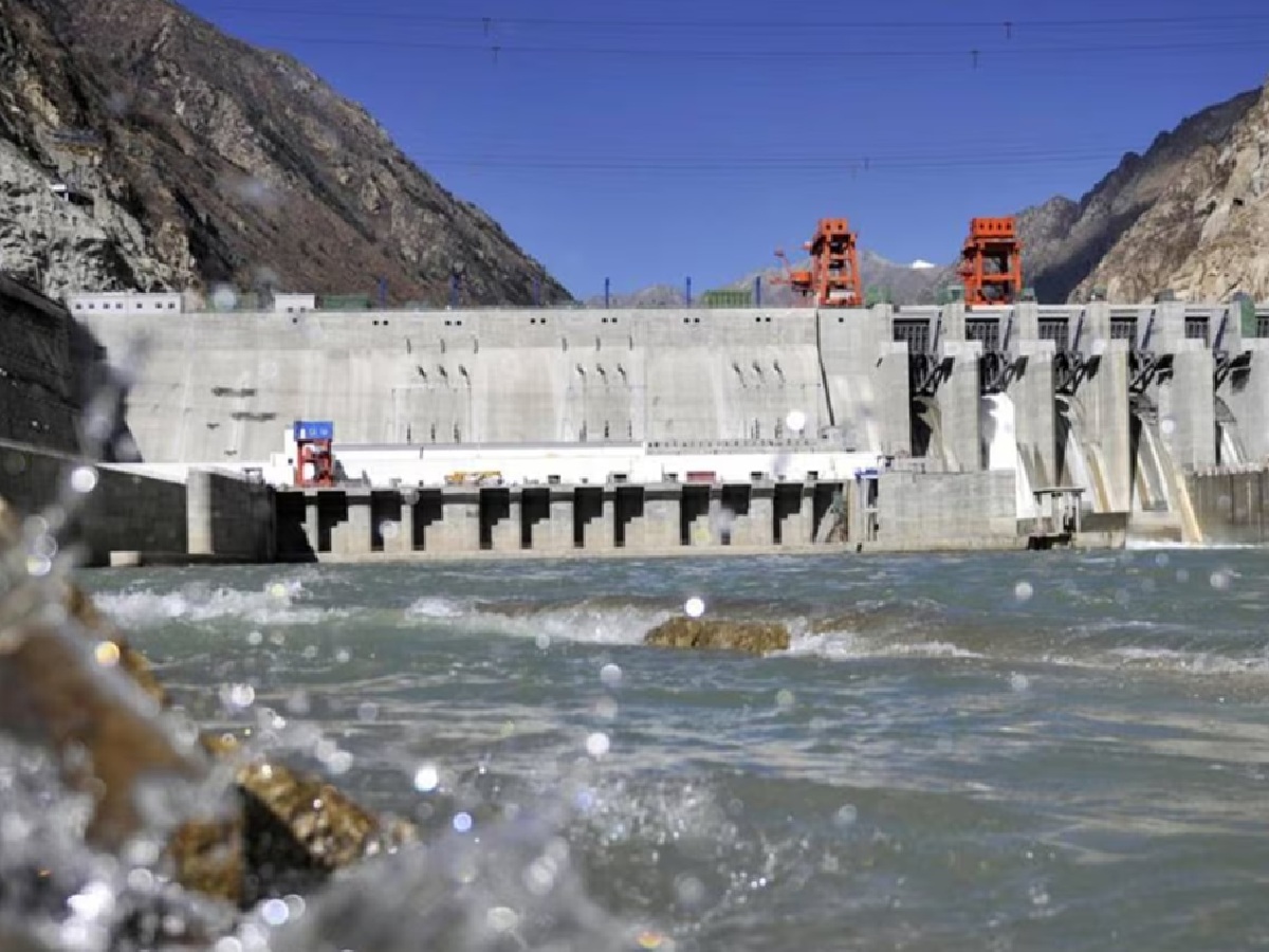
An unprecedented geological crisis is taking shape in the highly sensitive area of Tibet, just 50 kilometers from the India-China international border adjoining Arunachal Pradesh. China is building the world’s largest hydropower project ‘Medog Hydropower Station’ on the Yarlung Tsangpo (Brahmaputra) river here. Recently, a joint scientific study conducted by scientists from the Government Geological Survey of China and Chengdu University of Technology has revealed that this megadam is being built right above a very active and dangerous seismic fault line. This official warning from Chinese scientists has raised a huge question mark on the structural safety of this mega-project and the existence of the northeastern states of India located downstream.
Scary truth of Paizhan fault line: Big warning regarding structural stability in Chinese research paper
According to a detailed report by South China Morning Post, in a Chinese research paper published in the prestigious scientific journal ‘Sedimentary Geology and Tethyan Geology’, experts have identified the ‘Paizhen Fault’ located just below the Medog Dam site as the main threat. According to geologists, this fault line has been continuously active since the Pleistocene era (ice age that started about 26 lakh years ago) and even today, clear evidence of intense movement of tectonic plates has been found within it. Scientists have clearly warned that repeated geological vibrations have hollowed out and greatly weakened the rock bed beneath the region, rendering the entire land technically incapable of supporting the enormous weight of the massive 60,000 MW capacity concrete structure and its huge reservoir.
Three times more powerful than the Three Gorges Dam: the $137 billion mega-project and the ‘Great Bend’ of Yarlung Tsangpo
If seen on technical parameters, this project is going to be the largest hydroelectric structure ever built in the history of the entire world. Its total installed capacity is estimated at 60,000 megawatts, almost three times the capacity of China’s own existing Three Gorges Dam, and it is designed to generate 300 billion kilowatt-hours of electricity annually. Approved by the Chinese government in December 2024 and breaking ground in July 2025, a huge capital expenditure of about 1 trillion yuan (about 137 billion US dollars) is being spent on this project, with the final target of being fully operational by the year 2033. The dam is located on a stretch of the Yarlung Tsangpo River originating from the Angsi Glacier in Tibet where it takes a sharp turn near the Namcha Barwa peak, forming the ‘Great Bend’ and directly enters Arunachal Pradesh, India, where it is known as the Brahmaputra.
Weak hills and reservoir leakage: fear of artificial earthquake and devastating landslides
Scientists have pointed out another serious crisis in their research paper, saying that the internal geological structure of the mountains located around the huge reservoir of Medog Dam is extremely loose, sandy and weak. Once this huge reservoir is completely filled with water, the occurrence of hydro-seismicity (artificial earthquakes caused by water) can go out of control due to the continuous leakage of water and the immense pressure of water. This situation, combined with the active Paijen fault line, can cause devastating landslides and sudden collapse of mountains throughout the mountainous region. This dire scenario will not only end the lives of the Chinese engineers and workers deployed there, but can also completely collapse the main structure of this huge concrete dam.
The real challenge for India and Bangladesh: diplomatic fear of stopping water or fear of geological flood?
This geological dispute has come to the international arena at a sensitive time when tensions regarding water diplomacy in South Asia are at their peak. However, senior analysts like Dr Nilanjan Ghosh, a New Delhi-based hydrologist and river and water expert at the Observer Research Foundation (ORF), believe that the bigger and real threat to India and Bangladesh is geological rather than the possibility of China completely blocking the Brahmaputra waters. According to experts, China cannot completely divert the water of this river even if it wants to, because if it does so, China’s own upper Tibetan areas will be submerged in devastating floods due to accumulation of silt. Moreover, Tibet’s share in the total annual water flow of the Brahmaputra is only 10 to 15 percent; After entering the geographical boundaries of India, the powerful monsoon rains and dozens of tributaries give it the form of a huge super-river.
The most frightening and serious question that is currently facing the international community regarding this entire mega-project is not strategic or diplomatic, but completely related to human security. While the Chinese government’s own scientists are admitting that the world’s largest hydropower station is being built over a highly active and destructive seismic fault, the main concern is not how China will use this water as a weapon in times of war. Rather, the biggest fear is that if this dam breaks from the middle due to a major earthquake in this most sensitive and most intense seismic zone (Zone V) of the Himalayas, then the resulting deluge will push the Indian state of Assam and the entire North-Eastern India into the abyss of destruction.