 look news india

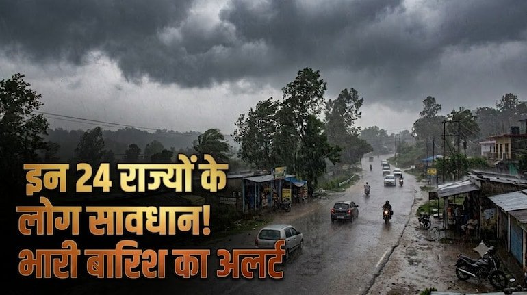
A major and widespread seasonal change is being seen in the weather scenario of the country today on 6 September 2026. The Indian Meteorological Department (IMD) has issued a warning in its All India Weather Bulletin regarding torrential rains, strong thunderstorms and lightning in 24 states and union territories of the country. According to meteorologists, a deep low pressure system formed in the north-western part of the Bay of Bengal is now rapidly moving towards Central and North India. Along with this, the monsoon trough line is active towards the south from its normal position, which has drawn a huge amount of moisture from both the Arabian Sea and the Bay of Bengal. Due to the combination of these two powerful weather systems, a blanket of dense clouds has spread over vast areas of North, East, Central and Peninsular India. The Meteorological Department has clarified that today in many states the speed of strong winds can reach dangerous levels of 50 to 70 kilometers per hour, due to which there is a strong possibility of direct impact on life, traffic and crops.
Today, Sunday is going to be full of heavy weather disturbances in the national capital Delhi and the entire adjoining National Capital Region (NCR). The Meteorological Department has issued ‘Orange Alert’ for Delhi, Noida, Greater Noida, Ghaziabad, Gurugram and Faridabad. There will be dense dark clouds in the sky throughout the day and there is a possibility of heavy rain with several rounds of thunder and lightning between afternoon and late evening. According to weather center Safdarjung, today the maximum temperature of Delhi may fall 4 degrees below normal and be recorded around 28 to 29 degrees Celsius, while the minimum temperature is expected to be 24 degrees Celsius.
The biggest concern today is about the strong thunderstorms and stormy winds, whose speed can reach 50 to 70 km per hour. Due to strong winds and heavy rains, the problem of waterlogging in major underpasses of Delhi, Dhaula Kuan, ITO, Ring Road and main intersections of Gurugram may deepen. Delhi Traffic Police and Disaster Management Authority have issued a strict advisory to drivers to exercise caution, not park vehicles under old trees or weak hoardings and drive carefully on submerged roads.
Monsoon will be active with its full strength in the plains of Uttar Pradesh and Bihar today. Meteorological Center Lucknow has issued a warning of widespread rainfall for entire Uttar Pradesh. There will be rain with strong thunderstorm in Meerut, Muzaffarnagar, Saharanpur, Ghaziabad, Aligarh, Mathura and Agra of Western UP. At the same time, a high alert has been issued in the districts of Central and Eastern Uttar Pradesh – Lucknow, Kanpur, Ayodhya, Prayagraj, Varanasi, Gorakhpur, Deoria, Basti and Rae Bareli due to torrential rains along with strong thunder and lightning.
The situation in the neighboring state Bihar also remains very sensitive. Patna Meteorological Center has issued a warning of heavy rainfall and lightning in 26 districts of the state. There is a possibility of intermittent heavy to very heavy rain in the capital Patna, Gaya, Bhagalpur, Muzaffarpur, Purnia, Darbhanga, Samastipur, Saharsa and Katihar. In view of the rise in the water level of major rivers like Ganga, Gandak, Kosi and Bagmati, the Disaster Management Department has instructed all the District Magistrates to keep a constant vigil in the coastal and low-lying areas. Farmers and laborers working in open fields in rural areas have been advised to take special precautions to avoid lightning.
The pressure of monsoon system is being seen maximum in the states of Central and Western India. Orange alert of heavy rain is in effect today in more than 30 districts of Madhya Pradesh including Bhopal, Indore, Ujjain, Jabalpur, Gwalior, Narmadapuram, Sagar and Rewa. Due to continuous rainfall in many parts of the state, the water level of Bargi, Tawa and Indira Sagar dams is rising rapidly, due to which many gates can be opened. People living in low-lying areas have been warned to move to safe places.
On the other hand, in the eastern and central parts of Rajasthan – Jaipur, Ajmer, Kota, Udaipur, Bhilwara, Sawai Madhopur and Bharatpur, a dust storm with a speed of 60 to 70 km per hour and subsequent heavy rain has been warned. Due to the moist winds rising from the Arabian Sea in the coastal and Saurashtra regions of Gujarat, torrential rains are expected to continue in Ahmedabad, Vadodara, Surat and Rajkot. Due to strong winds, incidents of uprooting of electric poles and trees may occur, due to which the teams of power distribution companies are on alert mode.
In the hilly states of North India, Himachal Pradesh, Uttarakhand and Jammu and Kashmir, the weather remains extremely dangerous due to the confluence of western disturbances and monsoon winds. There is a serious threat of cloudburst-like rain and landslides on sensitive mountain roads in Dehradun, Nainital, Chamoli, Uttarkashi and Tehri of Uttarakhand. Due to falling of boulders on national highways and high flow of rivers in Himachal Pradesh’s Kullu, Manali, Kangra, Mandi and Shimla, tourists have been given strict instructions to avoid unnecessary travel and stay away from river banks.
In Assam, Meghalaya, Arunachal Pradesh and Nagaland of North-East India, the flood crisis may deepen due to the spate of Brahmaputra and its tributaries. The South Indian states of Kerala, Coastal Karnataka, Andhra Pradesh and parts of Tamil Nadu will also receive intermittent moderate to heavy rainfall under the influence of cyclonic winds. Intermittent heavy showers are expected throughout the day in Maharashtra’s Konkan region and Mumbai also.
The Meteorological Department and National Disaster Management Authority (NDMA) have issued important safety guidelines for the general public and farmers in view of today’s bad weather:
-
Protection from lightning: In case of strong thunder and lightning, avoid standing under any big tree, iron pole or tin shed. If you are in an open field or field, immediately take shelter in a permanent house.
-
Caution while traveling by road: Visibility can be significantly reduced during heavy rains. Two-wheeler and four-wheeler drivers should turn on fog lights and headlights of their vehicles and drive slowly. Never take the risk of driving through flooded underpasses.
-
Use of electronic devices: During a thunderstorm, remove the main plugs of heavy electronic appliances (TV, fridge, computer etc.) and do not use landline phones.
-
Important advice for farmers: Keep the drainage paths in the fields clean immediately so that the standing crops do not get waterlogged. Completely suspend any kind of pesticide, fertilizer spraying and irrigation work for the next 24 to 48 hours. Tied the animals in a safe and solid enclosure.