 look news india

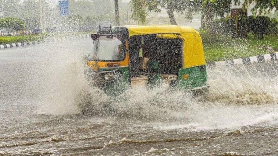
As the time of formal departure of the south-west monsoon from the Indian subcontinent approaches, there is a sudden dramatic change in the weather patterns. Normally, in the second fortnight of September, monsoon winds start returning from north-west India, but this time the low pressure area in the Bay of Bengal and the activity of western disturbance have once again recharged the monsoon clouds. According to the latest weather bulletin of the India Meteorological Department (IMD), intermittent heavy to moderate rain is expected to continue over northern, eastern and northeastern parts of the country during the next 48 to 72 hours. From the capital of Uttar Pradesh, Lucknow, Kanpur, Varanasi, Prayagraj, Gorakhpur and Noida-Ghaziabad to the national capital Delhi, the plains of Haryana, Punjab, Bihar and the Brahmaputra Valley of Assam, there is a camp of dense dark clouds in the sky. Meteorologists say that this rain may prove to be the last big spell before the departure of monsoon, due to which the temperature will drop but there will also be a danger of waterlogging and lightning in some states.
In the country’s capital Delhi and the adjoining National Capital Region (NCR)—Noida, Greater Noida, Ghaziabad, Gurugram and Faridabad—for the last few days, the scorching heat and sticky humidity of more than 80 percent had made normal life miserable. But the latest forecast of the Meteorological Department has given great relief to the people of Delhi. According to IMD, there will be partly to moderately cloudy sky in Delhi-NCR today and there is a strong possibility of light to moderate rain with thundershowers in many areas between afternoon and evening. During this period, gusty winds are also expected to blow at a speed of 30 to 40 kilometers per hour. At Safdarjung weather station today, the maximum temperature is expected to be around 33 to 34 degrees Celsius and the minimum temperature is expected to be around 25 to 26 degrees Celsius. Weather experts believe that the official withdrawal of monsoon from Delhi may start a little late this time i.e. around September 21. In such a situation, this intermittent drizzle for the next two days will keep the air quality (AQI) of the capital in the ‘satisfactory’ category and will also keep the temperature under control.
The Meteorological Department has advised to exercise special caution for Uttar Pradesh and Bihar. Due to the moist easterly winds coming from the Bay of Bengal, convective clouds (thunder clouds) are forming rapidly in the border areas of eastern Uttar Pradesh (Purvanchal) and Bihar.
-
Uttar Pradesh: Yellow alert of moderate rain with thunder has been issued today in the Terai belt districts including Lucknow, Barabanki, Ayodhya, Sultanpur, Varanasi, Jaunpur, Ghazipur, Gorakhpur, Deoria, Basti and Bahraich. Whereas, scattered showers are expected in Meerut, Moradabad, Saharanpur, Agra and Aligarh of Western UP. The department has expressed the fear of lightning strike, especially in rural areas, in view of which farmers working in the fields have been advised not to remain in the open.
-
Bihar: Monsoon is seen fully active in Patna, Gaya, Bhagalpur, Muzaffarpur, Purnia, Katihar and Kishanganj. Due to rains in the catchment areas of Nepal in the districts of North Bihar, a slight increase in the water level of rivers is also being recorded. Intermittent rain and lightning are forecast for the next two days in most parts of Bihar.
Monsoon trend remains most aggressive in Northeast India. The Meteorological Department has issued an ‘Orange Alert’ of heavy to very heavy rain for Assam, Meghalaya, Arunachal Pradesh, Nagaland and Manipur. Incessant torrential rains for the last 24 hours have disrupted life in Kamrup, Dibrugarh, Tinsukia, Dhemaji, Lakhimpur and Barpeta districts of Assam. Due to heavy rainfall in the hilly areas, the water level of Brahmaputra and its tributaries is rising rapidly, due to which the danger of floods and landslides in the low-lying areas is once again looming. Assam State Disaster Management Authority (ASDMA) and NDRF teams have been put on high alert. Visibility has reduced due to strong winds and continuous rain in Guwahati and surrounding areas, affecting traffic on hilly roads. The Meteorological Department says that there is no possibility of relief from heavy monsoon rains in the northeastern states till at least 18 September.
Interesting contrasts are being seen in the weather of Central and Western India at this time:
-
Rajasthan: The rainy season has almost stopped in Jaisalmer, Barmer and Bikaner areas of western Rajasthan and dry north-westerly winds have started blowing there. According to IMD’s indication, the process of official withdrawal of monsoon (Monsoon Withdrawal Line) from the western end of Rajasthan can start any time. However, there is a possibility of light to moderate rain with thundershowers in Jaipur, Kota, Udaipur and Bharatpur divisions of Eastern Rajasthan even today.
-
Madhya Pradesh: Cloud movement will continue in Bhopal, Indore, Gwalior, Jabalpur and Ujjain. Moderate rain may be recorded over eastern and southern parts of the state (Rewa, Shahdol, Chhindwara) due to local cyclonic circulation.
-
Gujarat and Maharashtra: Coastal areas of Saurashtra and Kutch are expected to see intermittent showers due to the pressure, while Mumbai and Konkan region will experience humid weather with light drizzle.
While the rains in this last phase of monsoon are like nectar for the late Kharif sown paddy crops, it can also become a cause of concern for the ripe crops and oilseeds and pulses. The Meteorological Department and disaster management agencies have issued the following life-saving safety tips for common citizens and farmers:
-
Protection from lightning: Do not under any circumstances take shelter under tall trees, electric poles, mobile towers or metal tin sheds during rain or thunder. Stay inside a strong concrete building.
-
Uses of Damini App: To get accurate and advance warning of lightning, keep the ‘Damini’ app of the Ministry of Earth Sciences downloaded in your mobile, which gives alert 15 minutes in advance of lightning within a radius of 20 kilometers.
-
Keep the harvested crops in a safe place: Farmers whose crops of maize, millet, urad or moong have been harvested should cover the crops lying in the barn well with tarpaulin or send them to safe warehouses so that the grains do not grow moldy.
-
Drainage in paddy fields: Where the paddy crop is still in the bud or ear budding stage, keep an eye on the waterlogging situation and maintain proper arrangements for draining excess water.
-
Road Trip and Waterlogging: Stay away from underpasses, waterlogged roads and open manholes in cities. Two-wheeler drivers should avoid driving during strong winds and heavy rains.
This last monsoon rain may be posing challenges in some areas, but it will prove to be extremely beneficial in terms of recharging the underground water level and leaving enough moisture in the fields for the upcoming Rabi crops (especially wheat and mustard).