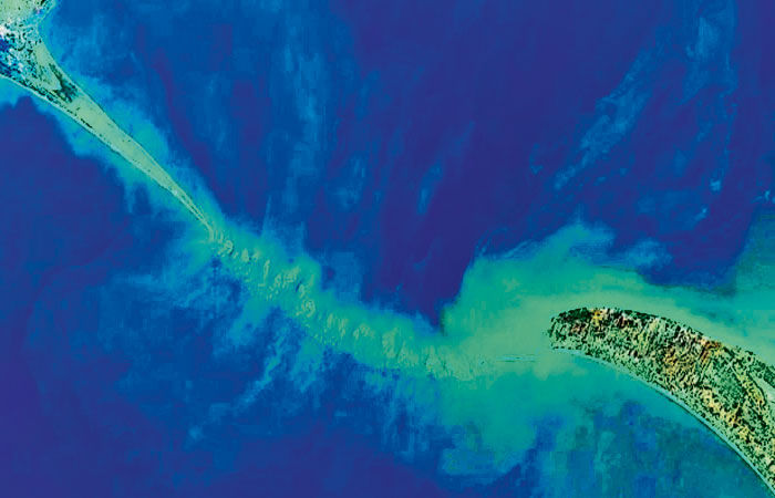
Ram Setu Map Released by ISRO: The Indian Space Agency has achieved great success in revealing the mysteries related to Ram Setu. ISRO has prepared a detailed map of Ram Setu, also known as Adam's Bridge, for the first time with the help of NASA satellite.
According to the report, the entire bridge can be seen in the 10 meter resolution map prepared by ISRO. For this, the agency has prepared data for 6 years between October 2018 and October 2023.
Scientists from ISRO's Jodhpur and Hyderabad National Remote Sensing Centre have published a report on this in a journal. In which this information has been given.
According to the report, an intricate detail of Adam's Bridge has been provided using photons from the NASA satellite ACESAT-2 water inlet.
According to the report, it is difficult to map the bridge from a ship because the water in this area is very shallow. Earlier it was possible to explore only up to the top of the bridge, but with the help of ICESat-2, researchers have been able to go deeper into the water.
This is the first such map of the undersea. It is 29 meters long and 8 meters above the sea level. Satellite images support this as 99.8% of the route is submerged in shallow and very shallow water. This ancient bridge connects Dhanushkodi in India to Talaimannar Island in Sri Lanka.
 look news india
