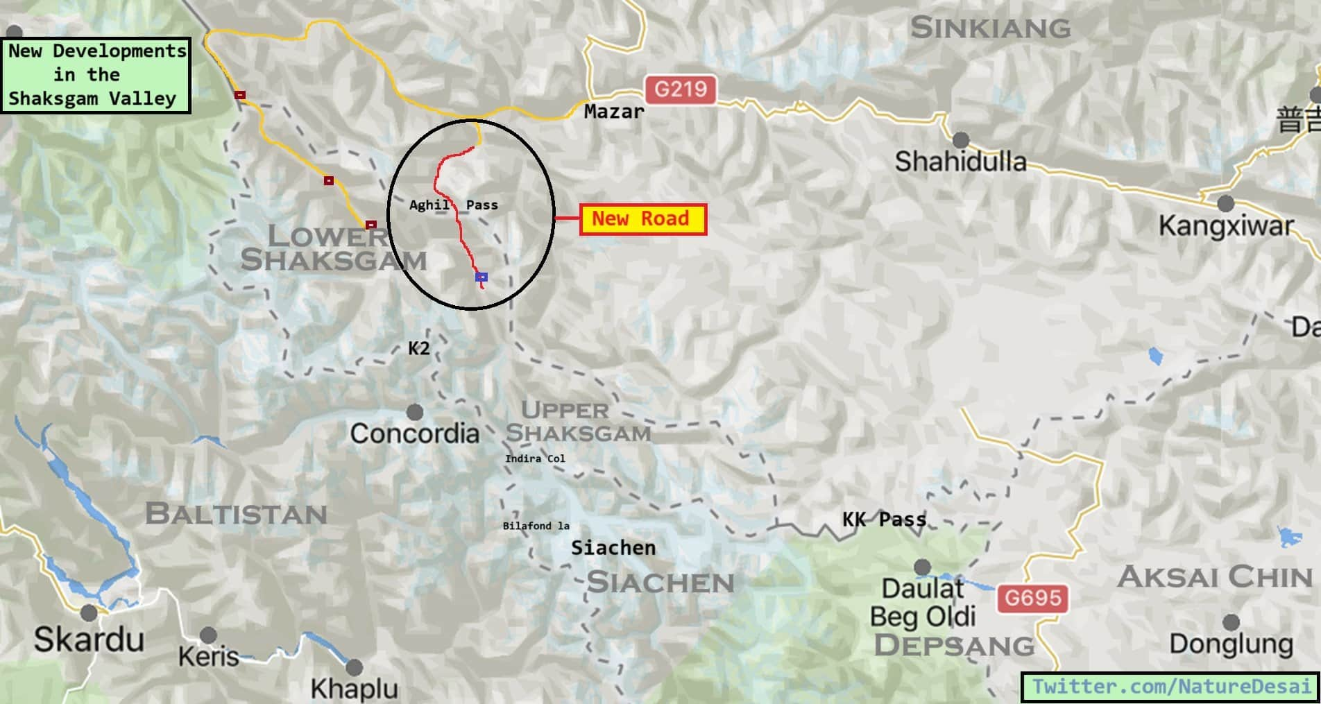
India China relations: China's dangerous plans have once again come to light. Latest satellite images show that China is building a paved road near the world's highest battlefield to encircle India. Actually, China is building a concrete road near Siachen Corridor in illegally occupied Kashmir. This has been revealed in new satellite photos.
China is building this road in Shaksgam Valley. Let us tell you that Shaksgam Valley was a part of Pakistan Occupied Kashmir (POK), but Pakistan handed it over to China in 1963. The road China is building originates from Highway G219 in its Xinjiang province and ends deep in the mountains.
Siachen Glacier 50 km away
According to a report, Indira Coal is located 50 kilometers inside the Siachen Glacier from where the road appears to end. This is the area where the Indian Army patrols. Defense Minister Rajnath has visited here twice since March. Satellite images taken by the European Space Agency show that the road was constructed between June and August last year.
The Fire and Fury Corps of the Indian Army is responsible for the security of Kargil, Siachen Glacier and eastern Ladakh. Its former commander Lieutenant General Rakesh Sharma said, 'This route is completely illegal and India should lodge its diplomatic protest with China.'

To transport uranium…?
According to the report, many observers believe that China's roads in the Shaksgam Valley may be primarily for the transportation of minerals such as uranium. Uranium is reportedly mined from Gilgit Baltistan to Xinjiang. The matter of concern for India is that this road is located in the Trans-Karakoram Path. This region has historically been a part of Kashmir and India has always considered it its territory. The latest official map published by the central government after the abrogation of Article 370 shows this area as Indian territory.
This route, spread over approximately 5,300 square kilometers, was captured by Pakistan in the 1947 war. After this, under a bilateral border agreement in 1963, Pakistan handed over this area to China. However, India never recognized it. Indian defense experts believe that any change in the status quo in this part of occupied Kashmir is a violation of India's sovereignty and territorial integrity. There are fears that infrastructure projects could jeopardize the existing security scenario in this mountainous region.
 look news india