 look news india

The Southwest Monsoon, which has been a lifeline for crores of farmers, water managers and common citizens of India for the last four months, has now officially departed from the entire country. The India Meteorological Department (IMD) issued a press release on October 15 confirming that the farewell line of the South-West Monsoon has also crossed the end of the country. Generally, according to the Long Term Average (LPA) of Indian weather, October 15 is considered to be the standard and ideal date of departure of south-west monsoon. While in the last few years, the withdrawal of monsoon had been delayed from 19 to 25 October, this time nature has followed its fixed calendar very well. With the dominance of dry north-westerly winds over North and Central India, a significant reduction in moisture from the lower troposphere and the disappearance of clouds, the curtain has officially fallen on the four-month long monsoon season. However, this farewell, along with relief, has also left a deep sorrow, as the distribution of rain remained uneven in many states and the final data showed a regional deficit of about 12 per cent.
The overall report card of this South-West Monsoon season is a living testimony of the complex geographical climate of India. Even though an attempt has been made to show the figures at the national level as close to normal, the ground reality is that in many important agricultural areas of the country, more than 12 percent less rainfall was recorded compared to normal. Especially in some sub-divisions of North-West and Eastern India, the indifference of monsoon winds has affected the last phase of Kharif crops. On the other hand, with the departure of monsoon, many areas of the country also suffered devastating excessive rainfall and floods. Thousands of houses in Faizullaganj, Gaughat and low-lying coastal areas remained submerged in water for weeks due to the rising water level of Gomti river in Lucknow, the capital of Uttar Pradesh, while the crisis of mud and diseases arose after the flood in Munger, Bhagalpur and Ganga plains of Bihar. This unbalanced rainfall has had a direct impact on the water level and groundwater recharge of major reservoirs of the country, raising concerns about irrigation management for the upcoming Rabi season.
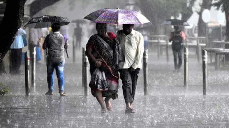
As soon as the South-West Monsoon bid farewell to the country, on the same day the North-East Monsoon has made a strong knock over Peninsular India. The cyclonic circulation over the south-western part of the Bay of Bengal and the coastal areas of Tamil Nadu has given tremendous speed to the northeast monsoon winds. The Meteorological Department has issued a warning that between October 15 and 21, torrential rains with thunder and lightning will continue over most parts of Tamil Nadu, Puducherry, Karaikal, Coastal Andhra Pradesh, Rayalaseema, South Interior Karnataka and Kerala. Orange and yellow alerts have been issued for Chennai, Chengalpattu, Kancheepuram and districts of coastal Andhra Pradesh, where there is a strong possibility of gale force winds up to 50 kmph and waterlogging in low-lying areas. This north-east monsoon is no less than a boon for Tamil Nadu, as the state receives about 48 percent of its annual rainfall in this season.
While on one hand South India is surrounded by monsoon clouds, on the other hand the weather patterns of North India have started changing completely. A fresh Western Disturbance has become active in the upper atmosphere of Jammu and Kashmir and Himachal Pradesh, due to which the first snowfall of the season has been recorded in the 11,650 feet above sea level Zojila Pass connecting Pir Panjal and Ladakh, Afravat peak of Gulmarg, Sonamarg and Gurez Valley. Cold and dry winds coming from the mountains have dropped the temperature rapidly in the plains of Delhi-NCR, Punjab, Haryana, Rajasthan and Uttar Pradesh. People have started feeling the need of light sheets and warm clothes during night and early morning. In cities like Lucknow, Kanpur, Meerut and Agra, the minimum temperature has dropped to between 19 to 21 degrees Celsius. Light mist and pink cold has started in the morning, which is indicating that this time winter is going to arrive before the scheduled time.
This dual trend of weather has created both new challenges and opportunities for the farming community of the country. Farmers in North and Central India are currently busy harvesting and threshing their main Kharif crops – paddy, maize, millet and soybean. Clear skies and dry weather have speeded up the harvesting work, but agricultural scientists have cautioned farmers to make adequate arrangements of tarpaulins in grain markets and fields to protect the harvested crops from sudden drizzle in some parts of North India due to western disturbance. On the other hand, the north-east monsoon rains that have started in South India will prove to be nectar for the sowing of Rabi crops, especially pulses, oilseeds and winter paddy. With adequate moisture available in the soil, farmers will be able to complete sowing work on time, which will help in completing the upcoming crop cycle on time.
According to meteorologists, the timely departure of the south-west monsoon is not just a seasonal phenomenon, but it is a big indicator of the nature of the upcoming winter. There are strong indications of ‘La Niña’ conditions becoming active in the equatorial Pacific Ocean. Historically, whenever the influence of La Nina increases, the Indian subcontinent sees a sharp increase in the number of days of severe cold, severe cold waves and dense fog in North India. The orgy of North-East Monsoon will continue in South India till the third week of October, while in North India, this trend of mild sunshine in day temperature and continuous decline in night temperature will gradually turn into a severe cold period. Amidst the changing weather patterns, health experts have also advised children and the elderly to take precautions to avoid seasonal flu, allergies and colds.