 look news india

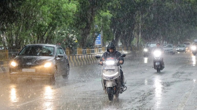
Monsoon activity in North India and East India has once again taken a severe form. The Indian Meteorological Department (IMD) has described the next 24 hours as extremely sensitive and challenging for most parts of Uttar Pradesh and Bihar. According to the Meteorological Department, due to the active monsoon trough line in the atmosphere and moist easterly winds coming from the Bay of Bengal, a serious warning of torrential rains, strong thunderstorms moving at a speed of 40 to 60 km/hour and lightning (thunderstorm) has been issued in both the states. In many sensitive districts, the administration has been instructed to remain on alert mode.
Alert of heavy rain and lightning in more than 30 districts of UP
Widespread rainfall with heavy thundershowers is expected over eastern and central parts of Uttar Pradesh during the next 24 hours. According to Weather Center Lucknow, there may be moderate to very heavy rain in Varanasi, Prayagraj, Gorakhpur, Deoria, Ballia, Ghazipur, Mau, Jaunpur, Azamgarh, Basti and Sant Kabirnagar districts of Purvanchal.
Along with this, there is a possibility of heavy rains along with strong winds in the Terai areas including the capital Lucknow, Kanpur, Ayodhya, Barabanki, Sitapur, Gonda and Bahraich. The Meteorological Department has especially instructed rural areas and farmers to be cautious of lightning, as loss of life and property has been seen due to lightning in the last few days.
Torrential rain from north to south in Bihar: rivers in spate
Monsoon activities are at their peak in Bihar. Patna Meteorological Center has issued ‘Orange Alert’ in northern and eastern districts of the state and ‘Yellow Alert’ in other parts. There is a possibility of extremely heavy rain in West Champaran, East Champaran, Sitamarhi, Madhubani, Supaul, Araria, Kishanganj, Purnia and Katihar.
Intermittent heavy rains with thunder and lightning will continue in the capital Patna, Gaya, Bhagalpur, Muzaffarpur, Samastipur, Begusarai and Nalanda. Due to heavy rains, the water level of Ganga, Kosi, Gandak, Bagmati and Kamla Balan rivers is rising rapidly, due to which there is a danger of flood like situation in low-lying and Diara areas.
Combined effect of monsoon trough and cyclonic circulation
According to senior meteorologists, the main trough of monsoon is currently passing over Uttar Pradesh and Bihar. Additionally, an upper cyclonic circulation is active in the atmosphere of eastern Uttar Pradesh and adjacent Bihar. This weather system is sucking huge amount of moisture from the Bay of Bengal, due to which dense thunder clouds (Cumulonimbus Clouds) are being formed. This is the reason why incidents of sudden strong winds and excessive rainfall and lightning in a limited time are increasing.
Administration’s warning: Take these important precautions during storms
The Meteorological Department and the State Disaster Management Authority (SDMA) have appealed to citizens to stay indoors and avoid unnecessary travel during inclement weather:
-
Distance from trees and poles: During strong storms and rains, do not take shelter under old trees, dilapidated walls, tin sheds and electric poles or transformers.
-
Farmers working in the fields should keep in mind: When there is lightning in the sky, instead of standing near open fields, ponds or water sources, go to permanent houses.
-
Urban Waterlogging and Traffic: There may be heavy waterlogging in low-lying areas and underpasses in the cities, so drivers have been advised to drive slowly and carefully.
-
Use of electronic devices: During a thunderstorm, unplug electronic devices from your home and avoid direct contact with landlines or metal objects.