 look news india

The dust storms and sporadic light rains in the last few days had definitely given some relief to the people of North India from the scorching and scorching heat, but today the weather pattern may change once again. According to the latest bulletin of India Meteorological Department (IMD), today on June 25, 2026, a slight increase in temperature may be recorded again in the plains of North India, due to which the humid heat will trouble people.
On the other hand, the havoc of South-West Monsoon continues in the southern and eastern parts of the country, where due to torrential rains, a serious flood-like situation has started in many districts. Let us know in detail how the weather is going to be in different states of the country and your city today.
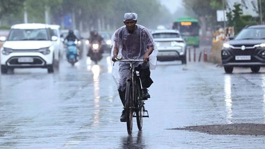
‘Western Disturbance’ active in North India; There will be showers with thunderstorms
According to meteorologists, a new Western Disturbance is currently active in North India. Due to its effect, there will be intense heat and humidity throughout the day in western parts of Rajasthan, Haryana, Punjab and Uttar Pradesh, but the weather may change suddenly in many areas in the afternoon or evening. There is a strong possibility of isolated showers with strong dusty winds and thundershowers in some parts of these states.
Meanwhile, the pace of progress of monsoon in the country remains quite good. The Meteorological Department estimates that today, on June 25, the monsoon will advance rapidly in the central and eastern parts of Gujarat, Madhya Pradesh, Chhattisgarh, Jharkhand, Bihar and Uttar Pradesh.
When will monsoon enter Delhi-NCR? New update from weather department
It is a matter of relief for the residents of Delhi-NCR that within the next 2 to 3 days, monsoon will cover a large part of North India, after which the official entry of monsoon in Delhi can also be announced soon.
Looking at the current weather system, IMD has predicted partly cloudy sky in various districts of Delhi today. Although the heat will persist during the day due to strong sunlight and humidity, there is a possibility of strong thunderstorm and lightning in the afternoon or evening. During this period, dusty winds can blow at a speed of 30 to 50 kilometers per hour in the capital, due to which there is a danger of reducing visibility on the roads and affecting traffic. The same situation will prevail in Noida, Ghaziabad, Gurugram and Faridabad adjacent to Delhi.
Today’s temperature and heat wave in Delhi-NCR
According to the Meteorological Department, there is no possibility of ‘heat wave’ in Delhi-NCR today, but due to very high level of humidity in the air, people will have to face sticky and humid heat.
-
Maximum Temperature: Today the maximum temperature in Delhi-NCR is expected to be between 38 to 40 degrees Celsius.
-
Minimum Temperature: The minimum temperature during night and morning can be recorded around 23 to 25 degrees Celsius.
Alert of heavy to very heavy rain in Konkan, Goa and Northeast India
On one hand, while North India is waiting for the main showers of monsoon, on the other hand, monsoon clouds are raining heavily in the states of South and North-East India.
-
West Coast: Heavy to very heavy rainfall will continue over Maharashtra (especially Mumbai and suburbs), Goa, Coastal Karnataka and Kerala for the next 24 hours. There is waterlogging in many low-lying areas of Mumbai after heavy rains in the past few days, where the local administration is on high alert.
-
North-East and Sub-Himalayan Region: Today the Meteorological Department has issued a ‘red alert’ of torrential rain in the North-Eastern Indian states of Assam, Meghalaya, Arunachal Pradesh and West Bengal (Sikkim and Dark Fleet regions) adjacent to the Himalayas. Due to landslides and rising water level of rivers in these hilly areas, people have been advised to be extremely cautious.